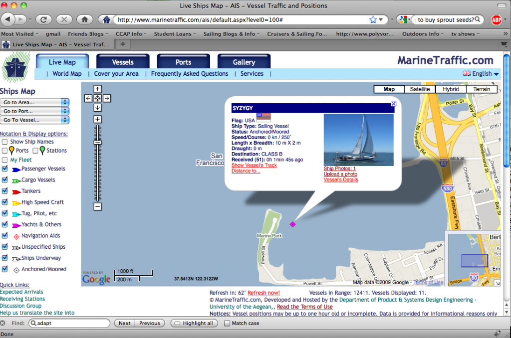
We are on the map!! The AIS map, that is. AIS = Automatic Identification System. It’s this super cool technology that’s required for all shipping vessels around the world and optional for little boats like us. When you have AIS you can transmit and receive signals from all other AIS users and you can find out all kinds of helpful stuff like:
– name of the boat
– its heading
– how far away it is from you
– its final destination
– its “call sign” so you can hail it if necessary
– sometimes even the name of the captain!
We’re very excited to have this for our own safety and so our friends and family (ok, let’s be real – our PARENTS) can go online and find out where we are! Caveat: running AIS takes power so there may be times when AAAH! now you see us, now you don’t. It doesn’t mean that we got ran over by a cargo ship or attacked by whales or anything, perhaps we just decided to turn it off so we could watch a movie instead. So, if you are one of the *radically awesome people* who check in on us every once in a while, you might be lucky to catch a glimpse of us on AIS!!
We’re still figuring out how the various websites work, but so far Marine Traffic is working well and Digital-Seas also has us on the map. From the 3 minutes of online googling I’ve done, it seems that some AIS maps only cover certain areas (i.e. Denmark) so we won’t show up in their signal. BUT – whenever we figure out where we are and which map we’re on, we’ll try to let everyone (PARENTS) know so you can see our exact position at (almost) all times. On those websites, you can search for us by vessel number (MMSI): 367430820.
How cool is that?!!??!!?!

 We left San Francisco on February 10, 2010 with a plan to head south to Mexico and then make the innocently named "puddle jump" to the South Pacific (!!) this spring. From there, who knows?!?!?!? Maybe Fiji? Australia? New Zealand? For now, we're just thrilled to finally be out at sea!


I appreciate this modern technology very much! Good idea to have it on the boat! Love U both!
MOM
OMG! I am so impressed and jealous! How’d you choose between the various AISs? Can I come check it out???
That is very cool. We are looking at a receive-only AIS right now.
Santa Barbara to Santa Cruz to Catalina // Feb 20, 2010 at 2:17 pm
[…] monitor the AIS and radar when needed, but I was still a little surprised. It was EERIE. But, thanks to AIS, we knew where we were and where all the other big mean boats were the entire time. That AIS is […]